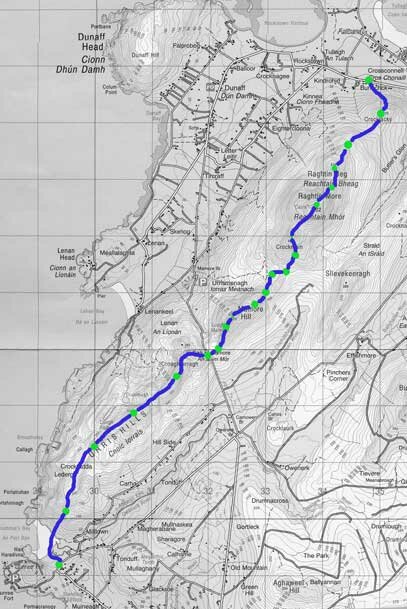
This is a fairly challenging nine mile walk northeastwards across a line of hills sculpted during the ice age. In clear air this trek provides some of the finest panoramic views in Ireland . It crosses the craggy Urris Hills consisting largely of ancient quartzite and reaches the road at Mamore Gap, an approximate halfway point and a good place for lunch . A steady climb over Mamore and Raghtin Hills follows and the walk finishes with a final drop to the road close to “The Rusty Nail”. The route provides some of the most spectacular panoramas in Ireland-on a clear day.

Lough Swilly and Derryveagh Mtns behind-from Urris Hills
The walk begins at the south end of picturesque Crummie ‘s Bay, lying below Dunree Head. The small bay is beautiful in late June, protected by sand dunes, dotted with orchids and fringed by blush pink wild roses.
Take the path through the dunes to the sandy beach of Crummie ‘s Bay, cross the Owenerk river which empties (usually gently) into the bay. Climb fairly easily up a damp, grassy valley from the north end of the bay towards Lederg and Crockfadda. At the top look back and admire the views across Lough Swilly towards Muckish and Errigal to the south. Looking east, you can see the wind farm on Bulbin (494m) for much of the route.
As you traverse the line of hills from one top to the next towards Mamore Gap, pass Lough Fad on the left, a long narrow lake of dark water lying between steep hills below. Lough Fad contains Arctic Char, an ancient fish species left after the ice age. Crunlough, in less rugged terrain , lies a little further northeast. Climb Cnoic Iorrais (418m), the highest point on this leg and continue across the tops until you see Croaghcarragh (365m) ahead. Either climb Croaghcarragh or keep well to its eastern side.
Study your map carefully and reach Mamore Gap ( you should pick up a grassy track). If you miss the gap on either side you entertain a steep uphill road walk. Enjoy a rest at Mamore Gap and contemplate Mamore Hill ( 423m) ahead, the first hurdle on the second leg of the walk. Just below the crest of Mamore Gap, on the seaward side, is a holy well devoted to St Eigne and a small alter of statues. A Mass is held here every August 15th in commemoration of Pagan Times when locals practiced their religion secretly to avoid persecution.
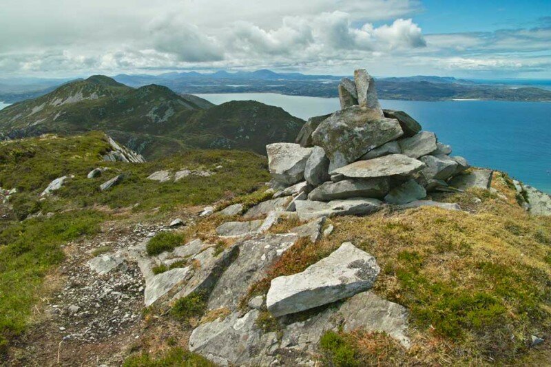
Across the road, you will find a discernible track, follow it to the top of Mamore Hill (423m) and continue northeast towards the eastern end of a stony path which can be seen in the valley below. From here find your way to the top of Crockmain (460m). Raghtin More with its impressive cairn can be seen ahead. Continue northeast and climb steeply over short turf and heather, interspersed with sharp edged quartzite slabs to reach the top of Raghtin More(502m) and its 4m high cairn. The views from here are spectacular.
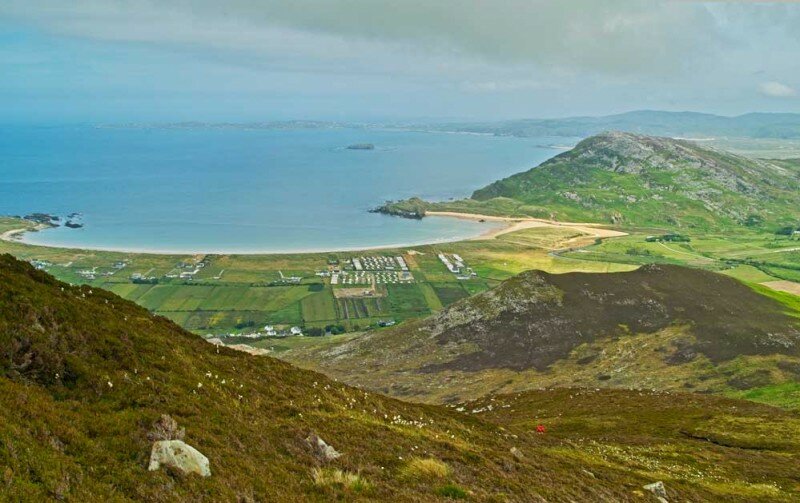
Follow the highest ground northeast to reach the top of Raghtin Beg ( 416m). Raghtin Beg provides a panoramic view from Dunaff Head to the west, east over Tullagh Bay and Pollan Bay to Malin Head beyond. On a clear day Scotland and the islands can be seen clearly.

Tullagh Bay-Inishowen
Resist the temptation to drop down towards heather and tall bracken which leads to an area of swampy ground, difficult to cross. Instead, continue towards Crocklacky below,through heather and bracken to reach the saddle. Contour around Crocklacky and descend towards the road, staying to the right hand side of the quarry which gashes the landscape below. The distinctive “The Rusty Nail” pub can be seen. You will soon reach the road.
Grid reference – Location
IC 294392 – Road at Crummie’s Bay
IC 296406 – Lederg knoll
IC 300413 – Prominent peak
IC 307419 – Highest point 417m
IC 320429 – Mamore Gap
IC 324436 – Mamore Hill (423m)
IC 331442 – Reach track
IC 332444 – End of track
IC 325(5)450 – Crockmain Top(460m)
IC 339455 – Raghtin More Top(502m)
IC 342462 – Raghtin Beg Top(416m)
IC 349469 – Saddle
IC 349477 – ‘Rusty Nail’

